Satellite-Based EUDR Compliance for Agricultural Supply Chains
Kumi Analytics' EUDR Compliance tool provides operators and traders with satellite-derived, audit-ready due diligence evidence for the EU Deforestation Regulation (EUDR). By combining optical imagery, SAR-based forest cover analysis, and authoritative datasets from the EU Joint Research Centre (JRC), Kumi delivers the geospatial evidence required to demonstrate that commodities — including palm oil, soy, cattle, cocoa, coffee, and timber — have not been produced on deforested land after December 31, 2020.
Request EUDR Assessment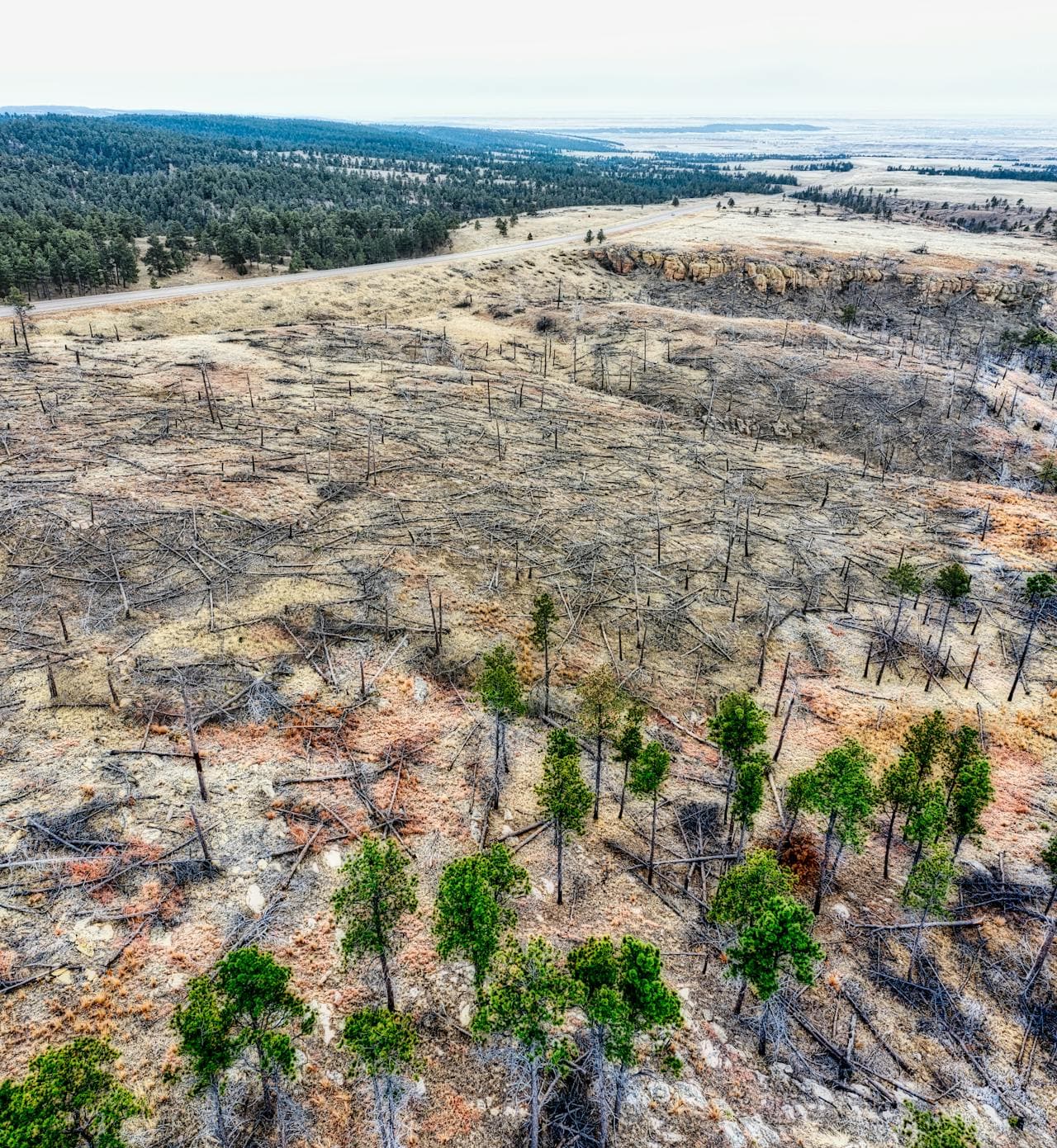
Flexible Geographic Data Support
Our tool supports a range of geographic data formats enabling easy integration with client data when needed.
Coordinates can be provided either as a point and radius or as a polygon. The system enables hand-drawn coordinates on a Google Map based interface, uploading a Shape File, GeoJSON, or KML, and Latitude & Longitude coordinates.
All inputs are automatically converted into a standardized format for your data repository.
All data is stored in WGS84 Map Projection.
Features of EUDR Compliance Tool
When you perform a due diligence study with us, you can be assured that the information you receive is backed by objective scientifically accurate data from authoritative sources.
Scientific Reports for Review and Submittal
Generate scientifically accurate due diligence reports backed by objective, authoritative datasets.
On-Demand Satellite Imagery Analysis
Analyze defined plantations and surrounding areas on demand to support monitoring and evidence generation.
Automated Compliance Reporting
Automate monthly, quarterly, yearly, and custom compliance reporting workflows.
Ad-Hoc Plantation Reporting
Produce ad-hoc reporting for individual plantations and collections of plantations from compliant to high risk.
Maps and Deforestation Calculations
Deliver supporting maps and deforestation calculations to strengthen due diligence decisions.
Anonymized External Reporting
Share anonymized reports externally while maintaining data privacy and regulatory traceability.
Authoritative Data and Standardized Outputs
Trusted Data Sources for EUDR Compliance
When you perform a due diligence study with us, you can be assured the information is backed by objective scientifically accurate data from authoritative sources.
- Use of authoritative data sources including the EU Joint Research Centre (JRC) for forest cover data
- Consistent geospatial standardization for internal repositories and downstream systems
- Audit-friendly outputs aligned with EUDR due diligence expectations
Frequently asked questions
Ready to Strengthen EUDR Due Diligence?
Talk to our team to evaluate your plantations, automate compliance reporting, and improve submission readiness.
Request EUDR Assessment